Posted 25 October 2014
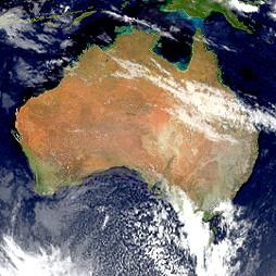
The Bureau of Meteorology this week released a new online groundwater data tool, providing a comprehensive picture of Australia's groundwater resources.
"The Australian Groundwater Explorer presents a uniform approach to groundwater information to support a range of sustainable water resource management decisions at both local and national levels," said Senator Simon Birmingham, Parliamentary Secretary for the Environment.
"The Australian Groundwater Explorer brings together comprehensive groundwater information from state and territory water agencies, making it publicly available in a nationally consistent format on the Bureau's website," Senator Birmingham said.
"As groundwater systems often span jurisdictional boundaries, policy and planning managers will value the national consistency afforded by the Australian Groundwater Explorer.
"National Water Week is a great time to increase community awareness around water issues and how best to use our valuable water resources. The Federal Government is working to improve our national understanding of all water resources, including groundwater, through the Bureau's Water Information Program.
"Groundwater has traditionally been considered our water resource safety net, but in this highly variable climate, with increasing demands from population growth and the pressures of development, we are relying more and more on our groundwater resources.
These increased pressures are part of the reason why we recently reinstated the $15.9 million Great Artesian Basin Sustainability Initiative funding, which Labor had left without funding.
"The Australian Groundwater Explorer is a valuable tool which will enhance public understanding of Australia's groundwater resources and lead to improvements in their management."
Senator Birmingham said with the Australian Groundwater Explorer users can access a wide range of groundwater data, including around 800,000 bore locations and bore logs.
"Users can pan and zoom using the interactive map, tailor and search information for their area, view bore logs and aquifers in 3D, or download tables and graphs."

Professor Andy Baker features in American Water Resources Association ‘Water Resources Impact’, September 2020 edition.

The Connected Waters Initiative (CWI) is pleased to welcome Taylor Coyne to its network as a postgraduate researcher. If you’re engaged in research at a postgraduate level, and you’re interested in joining the CWI network, get in touch! The CWI network includes multidisciplinary researchers across the Schools of Engineering, Sciences, Humanities and Languages and Law.

The Grand Challenge on Rapid Urbanisation will establish Think Deep Australia, led by Dr Marilu Melo Zurita, to explore how we can use our urban underground spaces for community benefit.

On the 21 August 2020, CWI researchers made a submission to the National Water Reform Inquiry, identifying priority areas and making a number of recommendations as to how to achieve a sustainable groundwater future for Australia.

Results published from a research project between the Land Development Department (LDD) Thailand and UNSW has demonstrated how 2-dimensional mapping can be used to understand soil salinity adjacent to a earthen canal in north east Thailand (Khongnawang et al. 2020).

