
The Fowlers Gap Arid Zone Research Station is an active sheep station covering 400km2 and lies abreast the Barrier Ranges on the Silver City Highway to Tibooburra, some 110km north-east of Broken Hill in New South Wales. It is a part of the School of Biological, Earth and Environmental Sciences (BEES) in the Science Faculty at UNSW.
UNSWTV video about the Fowlers Gap Arid Zone Research Station.
The geology of the area is complex with the eroded roots of the Pre-Cambrian and Cambrian Barrier Ranges cutting across the Station from north-west to south-east. A large area of Devonian sandstones occurs to the east of a major fault. These sandstones dip sharply to the east and are overlain by several 1000m of Tertiary deposits beneath the plains of the eastern part of the station. Several boreholes yield small quantities of water from these deposits.
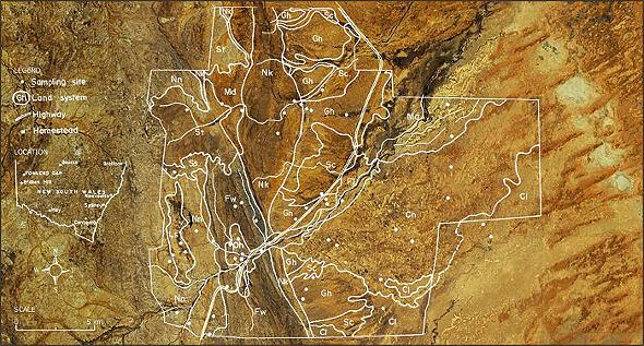 Land systems at Fowlers Gap superimposed on a Google Earth image. Image shows the Arid-zone research station boundary.
40 years of detailed rainfall measurements represent a unique hydrology resource for the arid zone that has international significance. The gauge density of approximately one per 20km2 exceeds most international observatories and provides a unique opportunity to research the impacts of climate change in semi-arid Australia.
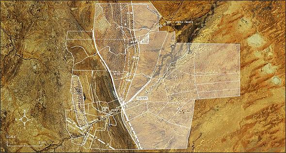 Basic geology at the Fowlers Gap arid-zone research station superimposed on a Google Earth image. Groundwater bores are shown.
This excellent base information, combined with the fact that the station is on a partly sealed road (Silver City Highway), has a secure mains 3-phase power supply and has TELSTRA T3 mobile phone coverage, made the redevelopment of the hydrological and groundwater monitoring facilities particularly appealing for the Groundwater EIF Project. The station is permanently occupied and there is a constant stream of visiting scientists carrying out research in the biological and botanical fields. The research station is regularly visited by student groups from a number of Australian universities. There are several different accommodation options available on site.
Rainfall Station | Mean rainfall (mm) | Max | Min | Rainfall Station | Mean rainfall (mm) | Max | Min |
Mandelman Bore | 189.74 | 416 | 40.2 | Sandstone Bore | 219.62 | 471.7 | 45.1 |
Gap Creek | 211.61 | 647.7 | 30.3 | North Mandelman | 197.39 | 461.1 | 45.9 |
Nelia Dam | 213.06 | 626.7 | 48.7 | Gap Hills | 214.47 | 792.9 | 40.4 |
Warrens Tank | 211.29 | 509.7 | 31.0 | Sandstone Tank | 219.45 | 611 | 50 |
Bald Hills | 202.20 | 385.7 | 31.75 | BOM Met station | 219.31 | 809 | 66 |
Mean annual rainfall for 10 stations across the Sem-Arid Research Staton for the period 1972 to 2011. The data in show a remarkable uniformity for a semi-arid environment during a time span that has included major floods and long droughts.
The opportunity has been taken to use the Groundwater EIF to replace the rainfall network with tipping-bucket rain gauges that can be downloaded over the 3G network and ported to the web. The original stream gauging station at Homestead Creek has been renovated and can now be viewed from a remote web camera.
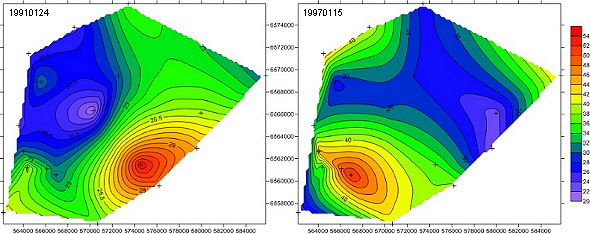 Maps of examples of rainfall events at Fowlers Gap from 24 January 1991 (left), 15 January 1997 (right). UTM grid (m) on X and Y axes, rainfall (mm) depicted by colour scale.
A new gauging station has been installed on the main creek at a conveniently located rock bar. Both gauging stations are instrumented by SonTek-IQ pulsed-doppler flowmeters (YSI inc) with the output fed through the data communications links so that flow can be remotely monitored on the Datawarehouse web page.
Fowlers Gap Research Station (yellow marker indicates UNSW compound and residential quarters) showing location of Homestead Creek data station (red marker on left) and Rock Bar data station (red marker on right). View Fowlers Gap Research Station in a larger map.
In addition to work above, 9 new groundwater monitoring sites have been installed in the Tertiary rocks downstream of the rock bar and adjacent to Fowlers Gap Creek. Groundwater levels at these bores will be linked to the data collection facilities and uploaded to the web. This location is close to the main road and also close to the UNSW compound and residential quarters. Proximity to the UNSW offices means that the gauging station can be easily monitored and maintained.
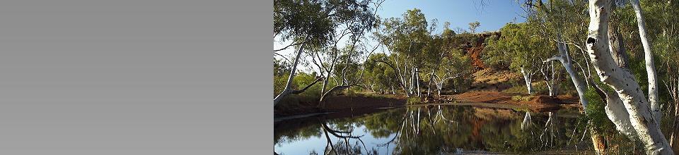
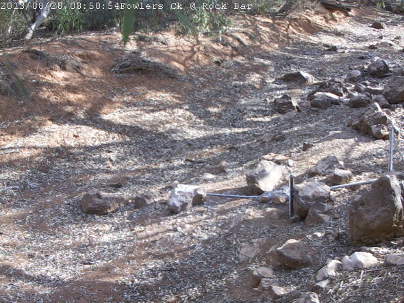 Video feed image from the Rock Bar stream-gauging station.