Posted 18 October 2011
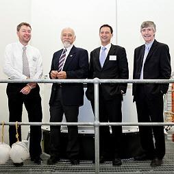
(Left to right): Prof Any Baker, Prof Ian Acworth, Dr Bill Peirson and Prof Graham Davies with the centrifuge permeameter.
A new machine at the University of New South Wales Water Research Laboratory can act as an environmental "time machine", allowing researchers to preview the long-term effects on groundwater aquifers of activities such as coal seam gas and longwall mining.
Researchers can use the centrifuge to study the movement of water and contaminants through clay layers, called aquitards, which often surround aquifers. By subjecting core samples of aquitards and "cap rocks" - rock which sits above some aquifers - to centrifuge testing, researchers can determine how much water or contaminant will move into or out of an aquifer once it is disturbed by drilling or pumping bores.
"It's basically like a time machine - you speed up gravity about 300 times beyond normal and that in turn speeds up the response of the aquifer to events such as water extraction and dewatering," said Professor Ian Acworth, Director of the Connected Waters Initiative (CWI) Research Centre at UNSW.
Professor Acworth said centrifuge testing could be included in environmental assessment processes for coal seam gas extraction and coal mining to give a clear indication of which aquifers were suitable for mining operations and which were vulnerable to compromise of water reserves.
The new centrifuge, funded by the Australian Research Council and the National Water Commission, is one of only two of its kind in the world, providing an optimal capability for core assessment. Research team member Dr Wendy Timms, of the WRL, said coal seam gas built up underground where "disconnections" - barriers such as clay or rock that obstruct the natural flow of water or gas - occurred.
"The key question is how the degree of connection might change when groundwater pressures change as a result of drilling and the centrifuge will help us understand that," Dr Timms said.
The centrifuge will add new capabilities to the work of the CWI and the National Centre for Groundwater Research and Training, of which UNSW is a member organisation. CWI is conducting research as part of the federal government-funded Groundwater EIF (GEIF) project. A new headquarters for the GEIF team has been opened at the WRL in Manly Vale. The facility will enhance coordination of GEIF research at Wellington (NSW), Willunga (SA), Ti Tree (NT), Namoi (NSW), Stradbroke Island (QLD) and Upper Ovens (Vic).
Links

Professor Andy Baker features in American Water Resources Association ‘Water Resources Impact’, September 2020 edition.

The Connected Waters Initiative (CWI) is pleased to welcome Taylor Coyne to its network as a postgraduate researcher. If you’re engaged in research at a postgraduate level, and you’re interested in joining the CWI network, get in touch! The CWI network includes multidisciplinary researchers across the Schools of Engineering, Sciences, Humanities and Languages and Law.

The Grand Challenge on Rapid Urbanisation will establish Think Deep Australia, led by Dr Marilu Melo Zurita, to explore how we can use our urban underground spaces for community benefit.

On the 21 August 2020, CWI researchers made a submission to the National Water Reform Inquiry, identifying priority areas and making a number of recommendations as to how to achieve a sustainable groundwater future for Australia.

Results published from a research project between the Land Development Department (LDD) Thailand and UNSW has demonstrated how 2-dimensional mapping can be used to understand soil salinity adjacent to a earthen canal in north east Thailand (Khongnawang et al. 2020).

