
Posted 12 May 2014
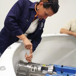
Geotechnical centrifuge.
Groundwater can be both a curse and a saviour for mining companies as they engineer ways of extracting Australia’s mineral wealth in a sustainable way.
Access to a plentiful groundwater supply hidden under a parched, hostile landscape is sometimes the difference between a mining operation being viable or not. But that same body of water can be a major operational and environmental headache if it hampers the mining effort.
As shallow mines become depleted, industry is going deeper and deeper to reach resources, working alongside or even below surrounding aquifers. In such cases groundwater can become a threat to mine safety making dewatering even more critical – and that requires high levels of expertise.
The ramifications of not adequately planning and managing underground mine dewatering can be significant and far-reaching. Safety can be jeopardised, profits hit, corporate reputations tarnished and sensitive ecosystems damaged. There are concerns that the rapid expansion of mining in some regions could have long-term impacts on aquifers through falling groundwater pressures, inter-aquifer leakage and contamination.
Mining companies are working hard to meet public expectation and in some cases the high standards set by their global parent companies exceed local regulatory requirements. When planning and operating their mines they must factor in the potential impacts of dewatering on the baseflow of rivers, springs, wetlands and other groundwater-dependent ecosystems. Extracted water which is surplus to mining requirements must also be carefully managed. This means looking much further than the visible footprint of the mine site and gaining greater insights into the surrounding hydrogeological environment.
Hydrogeology is a complex, specialist science and the mining sector is being supported with some breakthrough research driven by the National Centre for Groundwater Research and Training (NCGRT) headquartered in Adelaide.
Since it was established in 2009 the centre’s researchers have played a central role in expanding Australia’s knowledge of its groundwater systems.
Among them is Dr Wendy Timms, one of Australia’s leading specialists in underground water management who is using her expertise to support mining efforts. She says there is a need to look at both the short-term effect of mining and also the potential longer-term impacts on groundwater over 10, 50 and, even 1000-year timeframes.
“There are more than 50,000 abandoned mines sites in Australia and legacy issues relating to groundwater are appearing decades later,” Dr Timms said.
“While we have far more knowledge and expertise in the management of water at mine sites today, we are still developing the latest technologies to look ahead. We need to know that changes in water flows won’t cause problems well into the future.”
Dr Timms is Director of Postgraduate Courses at the University of New South Wales (UNSW) School of Mining Engineering and also leads the aquitard research program at the NCGRT.
 Dr Wendy Timms
A major focus of her cutting-edge study is on gaining a deeper understanding of low permeability strata, or ‘tight rocks’, which can create a highly effective natural barrier during dewatering. A key challenge of dewatering programs is the tendency for water to fill the space that has been created. This can lead to a need for more pumping and additional disposal issues. It can also have an impact on adjacent aquifers as well as surface water systems, leading to changes in flow directions and threatening dependent ecosystems. Understanding the properties and actions of aquitards – the natural rock barriers which restrict the movement of groundwater – is therefore a research priority.
Dr Timms said the study insights will help miners develop ways of protecting surface water systems from the impact of dewatering.
“Most research in the past has focused on more permeable fractured rocks and gravel where water can easily flow,” she said. “We’re now focusing on the opposites – rock and sediments where it’s very difficult for water to get through.
“If the geology is suitable and engineering design is effective you can have a space with no water not very far from a large body of water. It comes down to understanding how the water flows underground through the rock and sediment.”
Some of the answers are being provided by a revolutionary piece of machinery at UNSW. The university has taken delivery of a geotechnical centrifuge – one of only two of its type in the world – which acts as an environmental ‘time machine’ for mining projects. It can assess low permeability porous media, including tailings, to predict long-term impacts on groundwater from mining operations. The centrifuge is supporting Dr Timms’ research into groundwater barriers and coming up with some surprising results.
“We’ve discovered that the permeability and tightness of a rock barrier gets even tighter as the strata dries out,” she said. “Sometimes the water flows incredibly slowly because the rock strata is so tight, but over time that drip can be completely turned off by dewatering.
“If the rock remains intact without fractures, the tight rock strata becomes even tighter as it dries. This natural barrier means the water can’t rapidly flow back into the space left by dewatering.”
Such knowledge is critical for industry during the planning stages to keep water out of the mines so they are safe. It also provides a clearer picture of limiting factors affecting the recharge of artesian basins which can take hundreds of thousands of years.
Australia is fairly unique compared to mining operations in many other parts of the world in that miners have to be very careful with contamination from salt. Very low pH levels is another serious issue because once it goes down to low values in the acidic range it increases the mobility of metals such as zinc, lead and arsenic. The centrifuge is helping miners identify which rocks are more likely to release such contaminants so that they can be isolated. Centrifuge testing of salt and metal mobility through tight rocks and tailings involving time spans of decades and thousands of years can be assessed in a fraction of this time.
“It’s much less expensive and far more effective to proactively manage contaminants this way,” said Dr Timms. “If it’s done right up front then the risks down the track can be eliminated.”
Dr Timms and her NCGRT research team are working hand-in-hand with the mining sector in the eastern states and overseas to progress the research, and a similar partnership approach is proving successful in the west. Excess water produced during dewatering is increasingly used for water supply, industrial processes or agriculture, and at some mines where water is too salty or brackish, desalination is an option.
But in some cases, such as Rio Tinto’s Yandicoogina iron ore mine in the Pilbara, water is discharged along natural creek lines under licence. NCGRT PhD researcher Sarah Bourke is using some clever scientific detective work to gain a clearer picture of precisely what happens to the water once it is discharged. Understanding the movement of the water, and how it influences groundwater recharge, is essential for current mine operation and predicting how the water resource will recover after mining has ceased.
This is important knowledge not only for the mining operation but also for local groundwater and surface water ecosystems. Findings from the research project can be applied to both pit and underground dewatering at other mine sites to help with planning and avoid potential impacts on the environment.
Using gas tracers, Ms Bourke has been able to determine where the water has come from, the length of time it has been there and where it travels. The same results are not possible using non-gaseous solutes dissolved in groundwater because they don’t respond when exposed to the atmosphere in the same way.
“The research is providing an idea of the net impact of dewatering on the aquifer water balance and a better understanding of the amount of water that needs to be pumped out to keep the mine dry,” Ms Bourke said.
Ms Bourke’s research is also providing critical insights into surface water and groundwater interactions. Sometimes water leaves the creek and mixes with shallow groundwater before returning, centimetres, metres or even tens of metres further downstream.
“Using my new technique to measure these return flow paths we’ve discovered that this hyporheic exchange covers a much larger area than we expected, and this is important for understanding the ecology of these systems,” said Ms Bourke.
 Sarah Bourke
“Such flow dynamics are important for nutrient cycling and can create natural pockets with different temperatures, oxygen and nutrient levels which support healthy stream ecosystems.” watering Ms Bourke is working in partnership with Rio Tinto’s water resources evaluation team which has grown from one hydrogeologist to a staff of more than 30 people over the past six years.
With mining in the Pilbara expected to continue for at least another 100 years, their work is a priority for both operational and environmental outcomes. Ultimately, the researchers will integrate measurements from creeks and groundwater reservoirs to provide a holistic picture of the water cycle at Yandicoogina. This will provide a template for other mine sites across the Pilbara.
“An increasing number of mines in the Pilbara are extracting ore from below the water table and this produces a significant volume of surplus water across the Pilbara each year,” said Rio Tinto Principal Hydrogeologist Shawan Dogramaci.
“For long-term sustainability it’s important that we have a strategic view of the groundwater reserves for effective water management that takes into account such things as the cumulative impact, recharge rates and the potential impact of mining on groundwater dependent ecosystems.
“This is a dynamic semi tropical and semi arid environment region and we’re applying a systematic approach at each site to better manage our footprint.”
Since it was established in 2009, the National Centre for Groundwater Research and Training (NCGRT) has played a central role in expanding Australiaís knowledge of its groundwater systems.
The NCGRT represents a significant investment in groundwater capacity building through a comprehensive research and training program which cuts across disciplines.
Headquartered at Flinders University in Adelaide and co-funded by the Australian Research Council and National Water Commission, the NCGRT is addressing a national skills shortage in groundwater expertise through extensive training and upskilling.
It currently has about 140 chief investigators, postdoctoral researchers and PhD candidates and promotes global collaboration between nearly 200 Australian and international researchers who are undertaking projects conducted by the centre.
Strong collaborative links have been developed with the Commonwealth Scientific and Industrial Research Organisation (CSIRO), universities and other research institutions in Australia and overseas, as well as with industry and government partners.
Research at the NCGRT is focused on major national groundwater management issues identified by resource managers and industry, and includes field-based projects that deliver research in support of management and policy needs.
The research is grouped into key areas around the characteristics of aquifers and aquitards, hydrodynamics and modelling, surface water and groundwater interactions, and interactions between groundwater, vegetation and the atmosphere. A fifth research stream is investigating the social, economic, legal and policy dimensions of groundwater resource management, including community attitudes. It provides vital integration between social and biophysical research.
The NCGRT is a broad ranging research centre that is instrumental in helping to shape innovative and effective policy and governance for the sustainable management of Australia's groundwater future.
Groundwater level monitoring data recovered at the end of 2019 from Mystery Road at Breeza on the Liverpool Plains reveals a direct connection between the Gunnedah Formation unconsolidated sands and gravels and the underlying Permian coal measures. The connection is provided by the old deep channel of the Mooki River that cuts down into the coal measures. This is a crucial piece of evidence to be incorporated into groundwater models.

What are the effects of fire on water underground? Let’s think about what happens on the surface, and translate that to what is likely to happen to the subsurface.

The effects of tidal forces on groundwater might be less apparent to us than their effects on the ocean, but they’re just as important.

Dr Oliver Knox has brought together information from some of the industry’s researchers conducting work oncotton-producing soils.

Groundwater research at ANSTO has provided crucial information to support the management of finite groundwater resources appropriately and sustainably—answering questions about groundwater recharge, groundwater age and dynamics, the interaction between surface water and groundwater and salinisation.

Professor Andy Baker features in American Water Resources Association ‘Water Resources Impact’, September 2020 edition.
CWI’s network of researchers is widening - Welcome Taylor Coyne!

