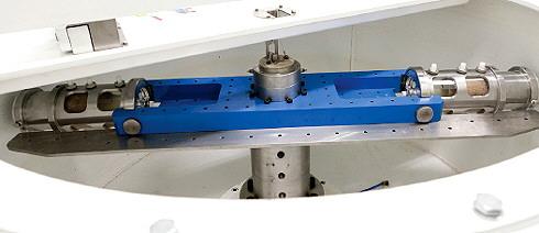
The geocentrifuge.
This resource introduces aquitards and aquicludes, and discusses some of the cutting-edge approaches used to understand the movement of water and contaminants through the ground. It is designed for a general audience.
Aquitards and aquicludes
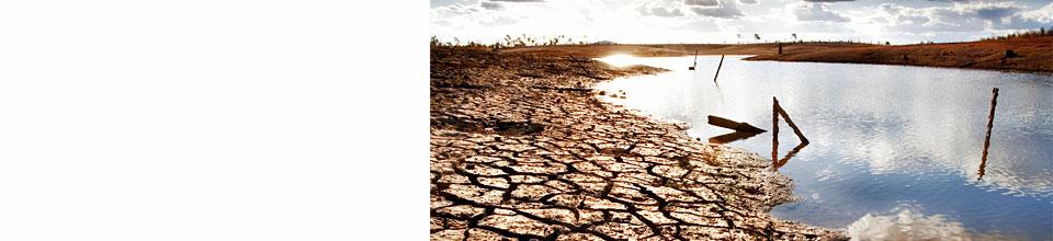
Although there is a common perception that groundwater is stored in huge underground caverns, in fact groundwater fills the pores of the various kinds of rocks that form the earth below us. Aquifers are underground layers of very porous water-bearing soil or sand.
Aquitards, by contrast, are compacted layers of clay, silt or rock that retard water flow underground; that is, they act as a barrier for groundwater. Aquitards separate aquifers and partially disconnect the flow of water underground. Also known as cap rocks, aquitards limit and direct the surface water which seeps down and replenishes aquifers.
Although water cannot flow very fast through an aquitard, significant quantities of water can seep through aquitards in some conditions.
At the very end of the spectrum, an aquiclude is a geological material through which zero flow occurs. However, it's usually difficult to distinguish aquitards from aquicludes. This is partly because of the impracticality of taking measurements in such tight materials, but also because research has historically focused on high-yielding aquifers, and relatively permeable reservoirs for oil and gas.
Carbon sequestration and leaky aquifers
Carbon dioxide (CO2) is the most important anthropogenic greenhouse gas linked to global warming. CO2 sequestration is the long-term storage of CO2 to reduce the amount emitted to the atmosphere: geological sequestration is currently the most viable option, and potential repositories include saline aquifers and un-minable coal seams.
A risk of underground storage is CO2 leaking back out to the environment, which would render the process ineffectual. Furthermore, CO2 sequestration can acidify local groundwater which may in turn cause heavy metals to dissolve and migrate. Also, the displacement of salty water caused by injection of large volumes of CO2 could impact upon shallower groundwater systems, depending on the level of connection.
Low permeability materials, known as aquitards or cap rocks, play an important role in confining sequestered CO2 as well as any water quality impacts. Understanding how well confined an aquifer is may help us to make sensible decisions about where to consider storing CO2.
A number of methods for assessing aquitard integrity and potential leakage are already used; however, all have drawbacks when used alone. CWI researchers Dr Wendy Timms and Dr Steve Bouzalakos are using the geocentrifuge to pioneer new methods to help assess the integrity of cap rocks for carbon sequestration.
Measuring groundwater flow
The movement of water and contaminants through relatively impermeable sediments and cap rocks is important to understand but challenging to measure.
Traditionally, various approaches have been used, including fieldwork, laboratory testing and mathematical modelling. Unfortunately, testing methods are often time consuming, expensive and have significant limitations. A multi-faceted approach is essential to fully understand complex aquitard systems; this includes understanding the integrity of aquitards subject to variable stresses and chemistry over time, the preferential flow paths of groundwater through faults and fractures, and the responses of aquitards to depressurisation and desaturation.
NCGRT research program 1 is entirely focused on characterising the hydraulic properties of aquifers and aquitards; this includes measuring the movement of water and contaminants, and identifying the significance of leakage pathways such as poorly sealed bores.
The geocentrifuge
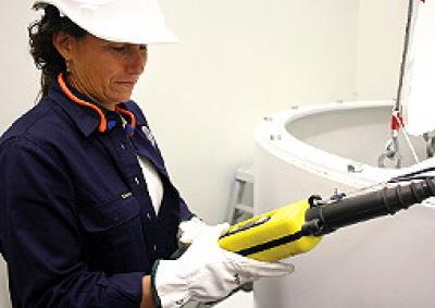
A new geocentrifuge commissioned by the National Centre for Groundwater Research and Training is one of only two of its kind in the world, and is used for assessing porous materials including geological core samples.
Located at the University of New South Wales, the geocentrifuge acts as a sort of environmental time machine - by speeding up gravity to about 550 times normal, the geocentrifuge accelerates water movement through core samples. Centrifugation can directly address questions about subsurface flow at scales that are not otherwise possible, simulating thousands of years within weeks or months.
By analysing geological materials in the geocentrifuge, researchers can study the movement of water and contaminants through aquitards. This can help researchers understand the properties of aquitards, as well as preview the long-term effects of activities such as coal seam gas and longwall mining on groundwater.
The geocentrifuge is being used by the NCGRT in conjunction with other cutting edge techniques, such as using time series resistivity imaging and borehole tomography to measure in-situ hydraulic storage and properties of aquitards.
The geocentrifuge is already being used to work out the permeability and conductivity of different geologic materials, and to identify significant aquitard leakage pathways, such as fractures.
In the future, the geocentrifuge may be used to:
In the spirit of collaborative research, the facility is available to researchers at a reduced cost, and provides services to industry. Since being commissioned in early 2011, the geocentrifuge has logged over 4600 hours of testing, and has been used for three contract projects for industry.
Mining applications
By subjecting core samples of aquitards to geocentrifuge testing, researchers can help determine how much water or contaminant will move into or out of an aquifer once it is disturbed by drilling or pumping.
Geocentrifuge testing could be included in environmental assessment processes for coal seam gas extraction and coal mining to give a clearer indication of which aquifers are suitable for mining operations and which require careful mitigation strategies.
Acknowledgements
Midland Valley (the developers of MOVE), ARANZ GEO (the developers of Leapfrog 3D), Geovariances (developers of Isatis), and Paradigm Geophysics (the developers of GOCAD). We gratefully acknowledge Prof Joan Esterle and Stephanie Hamilton at the University of Queensland for providing the Surat Basin data set.
Links and further information

Facts curated by Dr Landon Halloran, Dr Gabriel Rau and Dr Martin Andersen from UNSW Sydney. Graphics and design by Anna Blacka from UNSW Sydney. Funded by the NSW Research Acceleration and Attraction Program to support the Australian Government National Collaborative Research Infrastructure Scheme.

This resource introduces aquitards and aquicludes, and discusses some of the cutting-edge approaches used to understand the movement of water and contaminants through the ground.

Having a geologically realistic conceptual site model is important for characterising hydraulic connectivity throughout aquifer systems, and modelling water transit times.

The use of heat as a tracer promises to be an excellent alternative to traditional assessment methods for quantifying exchange between surface water and ground water.

There are two common mistakes often made when calculating how much groundwater storage levels have changed.