

$15 million has been invested in groundwater infrastructure, to establish long-term groundwater monitoring sites across Australia with a particular emphasis on groundwater change in response to climate variability.
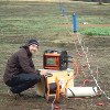
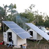
UNSW, Australia with collaboration of expertise from Flinders University, Australian National University, University of Queensland and Monash University have developed sites to provide advanced groundwater monitoring facilities. Some sites are connected to the web and updated every 24 hours. The majority of sites are updated manually.
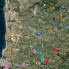
There are six main groundwater monitoring sites in four states. The sites have been selected to cover the range of climate zones and aquifer properties experienced in Australia. Further details of each site are below.
Web based databases allow a user to find any infrastructure item and to inspect the data (normally a groundwater elevation) and then to see how it has changed through time.
All infrastructure has been described in infrastructure reports. These reports give the essential metadata to provide the context for interpretation of the groundwater level hydrographs shown on the data base. These Infrastructure reports can be downloaded from the web site at the location where the level data is displayed.
The data is available to the general public and can be accessed from http://groundwater.anu.edu.au/.
 Wellington, NSW
The Wellington site focuses on fractured rock aquifers. Fractured and cavernous limestone at the Wellington Caves has a combination of boreholes, a weather station and instrumented caves, uniquely using caves as an observatory of vadose zone processes. Fractured granites at Baldry have surface water, ground water, climate and tree water use all instrumented. Fractured Ordovician volcanics and metasediments at the UNSW Wellington Research Station have a borefield of over 40 bores in both alluvial sediments and the adjacent fractured rock aquifer. Abstraction bores in both aquifers facilitate experiments such as aquifer tests (pumping tests) and tracer experiments.
 Willunga, SA
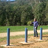
Infrastructure at the Willunga site focusses in five main areas: surface water – groundwater interaction; monitoring of seawater intrusion; mountain front recharge (and flow across fault zones); managed aquifer recharge; and leakage through aquitards. A total of 142 new piezometers and three climate stations have been installed at the site. Flow gauges on the Pedler Creek catchment have been resuscitated.
 Ti Tree, NT
Infrastructure at the Ti Tree site focusses on recharge processes in arid climates, and the interaction between groundwater and vegetation. A total of 106 new piezometers have been installed. Six water level indicators have been installed in the bed of the ephemeral Woodforde River, and two automatic camera systems have been installed to capture flow events. To monitor vegetation dynamics and water infiltration, we have also installed two eddy covariance systems, 8 automatic rain gauges, and 49 soil moisture sensors.
 Ovens Valley, VIC
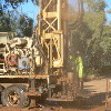
Infrastructure in the Ovens catchment includes 29 new groundwater monitoring bores, an Eddy Covariance Tower, one new and one refurbished surface water monitoring station, and soil moisture measurement installations. The bore network was constructed specifically to extend the existing State Monitoring Network by providing much more detailed monitoring near the Ovens River and its major tributaries, together with deeper bores (up to 65m deep) that extend into the basement below the alluvial sediments. This network will allow the detailed understanding of groundwater recharge as well as a better understanding of river-groundwater interaction.
 Namoi, NSW
The Namoi valley infrastructure has been established to develop an improved understanding of groundwater interaction with the Namoi, and Cockburn Rivers, and Maules Creek. A profile of double piezometers has been installed on the banks of the Namoi, close to the Maules Creek confluence. Maules Creek has both losing and gaining reaches and infrastructure (including two weather stations) has been installed in this part of the catchment and to provide permanent monitoring of the system. The Upper part of Maules Creek has been instrumented to estimate groundwater recharge from ephemeral streams.
 Fowlers Gap, NSW
Fowlers Gap infrastructure is located at a research station 110km north-east of Broken Hill in arid NSW. It builds on 40 years of rainfall measurements at the site, with gauge density of approximately one per 20 km2. A network of 18 automatic rain gauges, two flow gauges and a climate station have been installed along with 12 piezometers to investigate groundwater recharge processes in the arid zone.